
Sky and Signal: Drones, Starlink and India's Eastern Security Gap
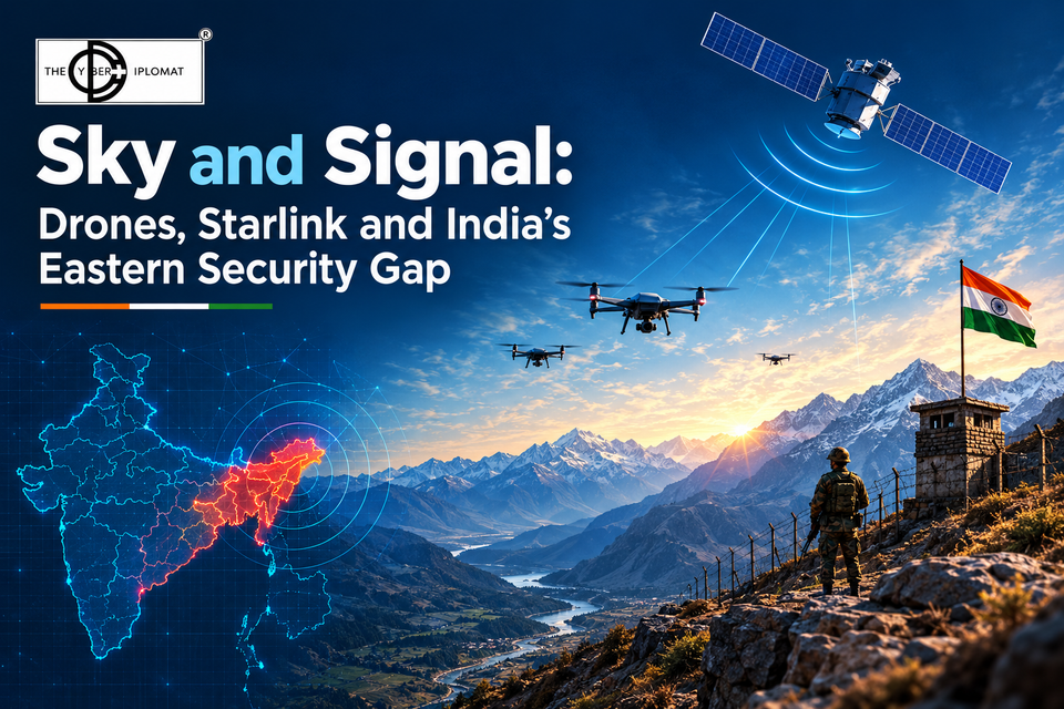
India's eastern border now faces a combination it has never had to plan for: a neighbour building a serious drone capability, and a licensed satellite internet service on the other side of the line that India does not control. Each is manageable on its own. Together they open a gap that sits between defence, telecom and diplomacy, and none of those systems currently owns it.
Bangladesh licensed Starlink in April 2025 and the service went live within weeks, while in India the same company is still waiting on spectrum and final security clearance more than a year after receiving its licence. That asymmetry is the heart of the problem. A border that is crossed every day by people and goods is now also crossed by radio coverage that India's telecom rules were never written to reach.
This piece looks at the drone build-up, the realities of the border, the Starlink split, the telecom cybersecurity questions it raises, and the regulatory grey zone in between.
Bangladesh's drone push: from buyer to builder
Bangladesh is moving from importing a few drones to producing them at home, with two foreign partners and sites close to India's most sensitive geography.
Date | Development | Why it matters to India |
|---|---|---|
2026 (reported) | Plan for a military drone factory beside Bogura airport, a joint venture with Turkey, alongside a new northern airbase (News Arena) | Production capacity in the north, near the Siliguri Corridor |
27 Jan 2026 | Bangladesh Air Force signs G2G deal with China's CETC International for a UAV manufacturing and assembly plant with technology transfer, starting with MALE and VTOL drones (Financial Express) | Chinese drone tech and supply chain embedded inside Bangladesh |
2025 | Plans to revive the WWII-era Lalmonirhat airfield, roughly 135 km from the Siliguri Corridor, with reported Chinese interest; the army said there were no current military plans (UNB) | A forward airfield near the "Chicken's Neck" |
Dec 2024 | Indian agencies detect Turkish Bayraktar TB2 drones operating near the border (Indian Defence News) | First persistent armed-capable UAV presence on the eastern front |
Two points deserve emphasis. First, a domestic factory changes the threat more than any single purchase. Imported drones are counted, tracked and limited by export licences. Locally assembled drones and their components are not, and analysts note the China deal could eventually open exports to third countries (AsiaNews). Second, Bangladesh's stated purposes, disaster response, maritime patrol and border surveillance, are legitimate. The concern is not intent today but capability that outlasts any particular government in Dhaka, in a relationship that has been volatile since August 2024.
Military drones are only half the story, though. The more immediate risk on a porous border comes from small commercial drones, and from what they can be connected to.
The border: long, porous and built for a ground threat
India's border with Bangladesh is 4,096.7 km long, and as of February 2025 about 864 km was still unfenced, including roughly 175 km the government classes as non-feasible (Lok Sabha reply). Long stretches run through rivers, chars and the Sundarbans, where the BSF relies on boats, cameras and tethered drones rather than wire (Business Standard).
The entire border-management model is designed to stop people, cattle and goods on the ground. A fence does nothing against a quadcopter. On the western front this lesson has already been learned at cost: the BSF recovered 278 rogue drones along the Pakistan border in a single year and now fields layered systems combining radar, EO/IR cameras and RF analysers (Tribune).
The east is earlier on that curve. A crashed Chinese-made quadcopter found near Petrapole in 2022 was described at the time as probably the first suspicious drone found on the Bangladesh front (EastMojo). The incentives for drone smuggling, though, are already there: the BSF's 2024 contraband seizures on this border were the highest in a decade, at about ₹461 crore (IMPRI). Smuggling networks that move drugs, gold and counterfeit currency across a river by hand will move them by air once the economics favour it, as they did in Punjab.
Drones also cut the other way. Recently a BSF surveillance drone came down in a field inside Bangladesh near Patgram, and Bangladeshi commentary floated the idea that it had been brought down by electronic warfare rather than a fault (UNB). Whether or not that is true, it shows how quickly a routine incident becomes a contested signal when both sides are flying.
Starlink: licensed on one side, waiting on the other
The same satellites now serve paying customers in Bangladesh while India keeps them dark over its own territory. That split is the new variable on the border.
Bangladesh | India | |
|---|---|---|
Licence | NGSO licence from BTRC on 29 April 2025, after the chief adviser ordered a launch within 90 days (Daily Star) | Unified Licence with GMPCS authorisation from DoT, plus IN-SPACe authorisation (Raksha Anirveda) |
Service status | Commercially live since May 2025, from Tk 4,200 a month (Daily Star) | Not live; spectrum and final security clearance still pending as of October 2026 |
Local gateways | Operated under a three-month waiver before four gateways were installed in Gazipur, Rajshahi and Jashore (Daily Star) | Gateways in India required; SpaceX says it has built 20 local gateway sites (NE Now) |
Security conditions | Traffic to route via local gateways; $1 per terminal to government | Lawful interception, India-only data, local control centre, user details for seized kits, power to restrict service in sensitive areas (Outlook Business) |
Distribution | Resold via Robi Axiata and state-owned BSCL | Distribution deals with Jio and Airtel, pending launch |
The contrast is not that Bangladesh has no rules. It is that the two regulators set different priorities. Dhaka optimised for speed and connectivity after the 2024 shutdowns. New Delhi has optimised for control, and the gap between them has turned political: on 8 October 2026 Elon Musk called India's delay a crime against its people, and the Ministry of Communications replied that every operator must clear the same security conditions before spectrum (Mobile World Live).
For border security, the important fact is geometric rather than legal. Two of Bangladesh's gateways, at Rajshahi and Jashore, sit in the west of the country, close to West Bengal. Satellite coverage does not stop at the zero line. Starlink can disable service by location, and Musk insists beams are "turned off over India", but whether that geofence is enforced precisely at the border, and who can verify it, is exactly the question India cannot answer on its own.
Telecom cybersecurity: when the link leaves India's network
The real risk is not Starlink as a company but satellite connectivity as a capability that sits outside India's telecom perimeter. Three threats follow from that.
India's satcom rules work only when traffic lands at a gateway inside India; route it through a gateway across the border and interception and shutdowns stop applying.
1. Drones that cannot be cut off. Counter-drone systems on the western front work largely by detecting and jamming the radio link between a drone and its operator, or by spoofing its GPS. A drone or ground relay with its own satellite uplink changes that. Control and video can travel over a high-bandwidth link that does not need line of sight to an operator nearby, so the operator can sit further back, possibly across the border, and local RF detection sees less. The war in Ukraine has shown at scale how satellite broadband turns cheap drones into networked weapons. Nothing about that requires a military-grade platform.
2. Traffic India cannot lawfully intercept. India's GMPCS framework requires Indian traffic to pass through gateways in India so that agencies can monitor it under lawful interception rules (TaxGuru). A terminal on Indian soil that connects through a Bangladeshi gateway defeats that design entirely. Its traffic leaves through Rajshahi or Jashore, under Bangladeshi jurisdiction, encrypted end to end. Indian agencies would see neither the content nor, in many cases, the metadata.
3. Shutdowns that do not shut anything. India uses regional internet shutdowns more than almost any other country as a crisis tool. Officials in Manipur told reporters that seized terminals had been used to get online during shutdowns, possibly smuggled from Myanmar (NE Now). A terminal brought across from Bangladesh, where it can be legally bought, would do the same in West Bengal, Assam or Tripura.
The precedents are already on record. In December 2024 the Army and Assam Rifles seized Starlink-labelled equipment alongside weapons in Manipur, and Andaman police found a Starlink Mini on a boat carrying about 6,000 kg of methamphetamine, the first time they had seen one used to navigate into Indian waters (Scroll). Musk's response, that beams are off over India, may well be accurate. But it makes India's security depend on a private company's geofencing, verified by that company. Starlink is also not the only operator: other low-earth-orbit constellations, including Chinese ones, are coming, and they will not be negotiating with DoT at all.
The regulatory grey area
Each legal system involved is internally coherent. The gap lies between them, and that is where a drone with a satellite link will operate.
- Indian telecom law stops at the licensee. DoT's conditions on interception, data localisation and shutdowns bind operators licensed in India. They have no reach over a Bangladeshi licensee, its gateways or its customers. A terminal bought legally in Dhaka and used in Malda is illegal in India, but enforcement depends on finding the physical device, which is exactly what satellite terminals make hard.
- International spectrum rules rely on the operator's good faith. Under ITU practice, an operator should only serve countries where it has landing rights, and satellite footprints routinely spill across borders. There is no international mechanism for India to audit whether a foreign operator's geofence actually holds along a 4,096 km line.
- Bilateral border arrangements are built for the ground. India-Bangladesh cooperation runs through BSF-BGB protocols on fencing, patrols and crime. There is no agreed framework for satellite spillover, terminal tracking, shared lists of seized devices or notification of drone flights near the zero line. Even the existing fencing protocols are contested, with BGB objections cited by India as one reason fencing is incomplete (Lok Sabha reply).
- Drone law and spectrum law do not meet. India's drone rules govern registration and where drones may fly. Telecom rules govern which radios may transmit. A drone carrying a foreign satellite terminal falls between the two, and authority to jam or take down such a drone near a populated border is limited to specific agencies and procedures.
- Dhaka's own oversight is untested. Bangladesh let Starlink operate on a waiver before its gateways were ready (Daily Star). Its interception and terminal-registration regime is young, and its willingness to share data with Indian agencies depends on the state of a strained relationship.
The result is a seam that no single authority owns. The BSF watches the ground, DoT regulates Indian operators, the IAF watches large aircraft, and MEA handles Dhaka. A small drone relaying video through a Bangladeshi gateway touches all four and belongs to none.
What India should do
India's leverage over Starlink is greatest now, before its service switches on, and it should use that leverage for the border rather than only for the licence.
Technical
- Extend eastern counter-drone coverage on the western model: radar, EO/IR and RF detection at known smuggling nodes, plus detection of satellite uplinks, not just drone control links.
- Field direction-finding for satellite terminals in border districts, so an active terminal can be located the way a rogue mobile tower can.
- Build an Indian-controlled way to verify, and if needed deactivate, any terminal transmitting from Indian territory, a demand already raised in Indian policy commentary (Raksha Anirveda).
Regulatory
- Make cross-border geofencing a licence condition: any operator authorised in India must enforce a defined no-service buffer along the Bangladesh, Myanmar and Nepal borders, verifiable by Indian monitoring, and must report terminals that attempt to connect from inside it.
- Close the drone-and-spectrum seam with a single rule covering drones that carry satellite or foreign telecom equipment, and a clear authority to neutralise them near the border.
- Publish the security conditions and a timeline. Opacity breeds the kind of public fight seen in October 2026 and weakens India's hand with every operator.
Diplomatic
- Propose a BSF-BGB protocol on drones and satcom: notification of flights near the zero line, shared registers of seized terminals, and a hotline for crashed or stray UAVs.
- Raise satellite spillover with operators directly and in ITU forums, since the same problem will recur with every new constellation, including Chinese ones.
- Treat Bangladesh's drone factories as a supply-chain question as well as a military one: components and know-how leak into commercial and criminal markets.
Sources
- Financial Express (BD): BAF signs drone deal with China's CETC
- AsiaNews: Chinese drone production in Bangladesh alarms India
- News Arena: Bangladesh to build drone factory in Bogura
- Indian Defence News: Twin drone threats from Pakistan and Bangladesh
- UNB: BSF drone in BGB custody; Lalmonirhat airfield
- Lok Sabha Unstarred Question 1175, Feb 2025: border fencing
- Business Standard: Israeli tethered drones in Dhubri
- Tribune: BSF anti-drone operations and 278 drones recovered
- EastMojo: Chinese drone found near Petrapole
- IMPRI: India-Bangladesh border fencing and seizures
- Daily Star: Starlink gets BTRC licence
- Daily Star: Starlink launches in Bangladesh
- Daily Star: Starlink establishes four local gateways
- Raksha Anirveda: India is making Starlink earn the right to switch on
- Outlook Business: Satcom rules on seized kits
- TaxGuru: Starlink India security clearance explained
- NE Now: Manipur Starlink dispute and gateways
- Mobile World Live: Musk and the Ministry of Communications
- Scroll: Musk rejects Manipur claims; Andaman seizure
Member discussion